Sunday, July 24, 2016

Day 4 of trip north - Saturday July 23, 2016

Happy birthday, niece Jennifer!    Our itinerary today is not very extensive.  We planned on going into Leitchfield, a town about 20 miles south of the park, to hit some indoor flea markets, and then later try to find Green Farm, a 3000 acre old homestead.

In the parking lot of The Vendor's Village, there was an outdoor flea market.  The owner of this horse and buggy was either selling or "junkin' ".  We didn't meet him to find out which.
The size of both of the indoor markets was deceptive from the outside.  Each had aisles and aisles of crafts, antiques, collectibles, and someone's trash that could be a treasure.  We, however, did not find any. 

We did find Green Farm and the old mill, but it is no longer a tourist attraction, per se.
The ancestral home has been turned into a bed and breakfast as part of a golf resort.
The old mill which used to produce 3 grades of flour: Grayson Lily; White Rose; and "Good Enough" is almost collapsing into the Falls of Rough.
The general store is still standing, but not safe for touring.

The bridge was sturdy enough for foot traffic...
...and to imagine what the life here used to be like.
We later stopped back at the state park.  It was very crowded.  The lake was churning with  boat and water ski traffic.  Back at the our campground, dogs were barking and some yahoo was setting off fireworks (against park regulations) for over two hours.  We decided we had exhausted our sight seeing opportunities in the area and chose to forfeit one night's stay in lieu of taking back roads up to Michigan and making the trip in two days rather than one on the interstate.  We both agreed we would not want to stop at this Army Corps park again.


Saturday, July 23, 2016

Day 3 of Trip North - Friday July 22, 2016

It was an overcast day, so we thought it would be a good time to do some sight seeing.  We decided to take a ride down KY 259 to Mammoth Cave National Park, about 50 miles away, and from there, like the bear that went over the mountain, we would see what we could see.  We weren't going to go on any of the cave tours.  Neither of us thought we could make the climb down into the cave nor walk the tour comfortably.  But, being so close to a national landmark, we wanted to drive there.
The park contains the longest cave system currently known.  It became a national park in 1941.  There are 52,830 acres around the Green and Nolin Rivers with 400 miles of explored cave passages.  Stories vary as to how the first cave was discovered.  The most popular is that back in 1797 one of the local Houchin brothers was either chasing a bear or being chased by one and found a cave opening.
A park employee in period costume...not one of the Houchin brothers.  The visitor center was a buzz with visitors.  We haven't seen so many folks since our cruise in April.
In the past, there were several ferry crossings along the Green River around the park.  The boats were large enough to carry the pioneers' wagons.  Some of the ferries are still operational, although modernized.  Here is one getting ready to load autos coming from the ramp in the background.
 Up the road from the ferry crossing, on the way out of the park, we spotted this young deer.
We were sure we would spook him, but to our surprise, our presence didn't deter him from having his snack.
On the way to the park, we had seen a sign for a produce market, and decided to stop on our way back.
We weren't sure what we would find when we saw this sign and the road that was probably wide enough for only this type of conveyance.
We were delighted with what we did find.
The young shopkeeper explained that they were a commune of  Old Christians living an Amish lifestyle in that they did not use electricity or anything electrical.  Although she gave me permission to take her photo, she said she wasn't supposed to "pose" for one, so I told her I would take a picture of the quilt on the wall behind her.  We bought some sweet corn; red potato; cantaloupe; pumpkin roll; and peanut butter cookies.  The produce was grown on the farm and the baked goods were home made.  She said we could drive around the farm if we wanted, so we did take a little tour.
In back of the vegetable garden, one of the farmers is using a manual baler being pulled by one of their horses in preparation for rolling the cut hay.
Another work horse resting in the pasture
This young lady is carrying a watermelon under each arm back to her home on the farm.
Laundry on the line...no dryers here.
We let the horse and buggy pass before heading out
Up the road from the farm, we saw a sign for Nolin State Park.  We stopped at the tailwater picnic area of the dam.
This dam was completed in 1963.  Lake Nolin is a 5795 acre lake formed by the Nolin and Green Rivers.
Sure hope that dam holds!!!
A glimpse of Lake Nolin from the road at the top of the dam. For not planning the day, we had a really good time.  The deer and the farm were the highlights of the day for me.  For Bob is was the farm and the dam.  And when we got home and tried the fresh cantaloupe, that ranked really high, too.


Friday, July 22, 2016

Day 2 of trip north Thursday July 21, 2016

We had crossed into the central time zone going from GA to TN, so Thursday we had an extra early start.  Anxious to keep moving, we packed up and once again took scenic highways to our next stop at the Rough River Lake recreation area.  Although we had our GPS and directions from the website, I doubt if we would have ever found our actual campground if we hadn't stopped at the state park lodge and got a map.  Once situated at our site, we drove around a little to get a feel for the area.  The campsites at this Corps park are not as generous as others we've been to, and had very limited lake sites, all of which had already been reserved.
We thought the Kentucky countryside was beautiful with its farms and pastures.
It looked so green everywhere.
This is a view of the Rough River lake after crossing the dam's bridge.  The lake encompasses 5100 acres.  The Army Corps maintains 6 different recreation areas on the lake.  Construction on the dam began in 1955 and was completed in 1961 as part of the Ohio River Basin flood control plan.
 
 Maintenance work is being done on the dam.
We arrived at our site about 3:30 CST, taking 6.5 hours to go about 220 miles.  While nicely maintained, the spaces are a lot smaller than most Corps parks we've been to.
After setting up, we decided to go back to the state park, where there are many recreational activities, and admission to the park is free.  However, the swimming beach there was closed.  Due to construction on the dam, water level on the lake side is extremely high, making it too dangerous to swim at this beach.
Trees that normally would be on land are now several feet under water.
 
The main walkway to the park marina was also submerged.
I took the ramp in the background to get to the marina to ask about boat rentals and fishing licenses, despite what this sign read.
These are just some of the many pontoons moored at the marina.
The carp swimming at the back of the marine shop were enormous, and begging to be fed.  With the "no fishing" restriction, they've gotten to be quite big.   We are pretty sure we will just do our usual drive around sightseeing.  For today, though, it was time to get back to camp.


Heading North July 20, 2016

Now that we have our new little travel trailer, it's time to hit the road and visit some family.  We plan on seeing my brother Joe, his wife Bev, and their family in Michigan; visit with Bob's sister in Ohio; and then connect with his daughter in Georgia before heading home early August.  Rather than drive straight thru to Michigan, we decided to make a couple of stops along the way.  First night's destination was an Army Corps of Engineers Park called Seven Points Campground on J. Percy Priest Lake outside of Nashville, TN.  It was about a 350 mile trip that we made in around 6.5 hours while managing to avoid the busiest of interstates. We crossed over the Tennessee River and drove on byways carved through granite mountains.


Seven Points Campground was established in 1968.  It was one of the first Army Corps projects to be designated as a recreation area.  The lake is 42 miles and encompasses approximately 14,2000 surface acres.  There are 59 camp sites at this facility within 19,000 acres of woodlands.
Our site was very spacious, private, and right on the lake.  
There was a small beach and swimming area to the north of us.
But with the rocks and plants, it was a better place for the ducks and fish
Even though it was over 90 degrees, Bob couldn't resist building a campfire, especially since wood had been furnished for one.
 In the early evening, breezes crossing over the lake dropped the temperature...
...and made it comfortable to enjoy a beautiful sunset. 


Saturday, July 9, 2016

Day trip into Georgia - Friday July 8 2016

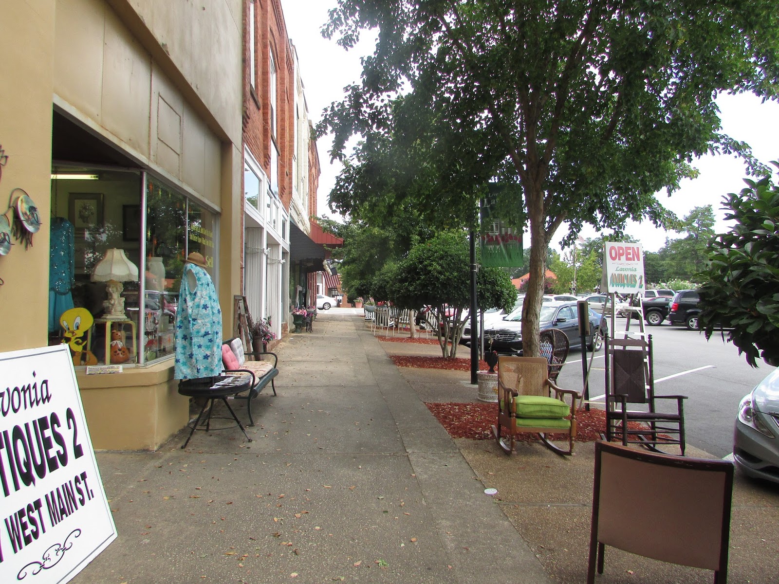
Temperatures have been in high 90's, and today it is supposed to hit 100.  We thought it would be a good time to take a ride to Tugaloo State Park near Martin, GA.  It was about a 45 minute drive.  The park is along the south end of the Tugaloo river that forms an arm of Lake Hartwell. The river was named after a Cherokee town that was once on the banks of the river.  The park has 393 acres, several boat ramps and picnic areas, a swimming area with sandy beach,  tent, yurt, and RV camping sites, and rental cottages.  There were about 105 RV sites, but they were not as spacious as the ones at the Corps of Army Engineer parks.  After driving through the park, we rode to Lavonia, a quaint little town not far from the SC border, and had lunch at a mom and pop diner before heading home.
Entrance fee is $5 per car; not bad for a full day of family fun
A boat ramp closest to the park entrance
 The lake level is down 3 feet.  Folks were swimming outside the cordoned area where the depth would normally be about 6 feet.  
Bob sporting the new cap he bought at the park's general store.  For some unknown reason,  there were no bbq grills in this area.  It was comfortable in the shade with breezes coming off the lake.
I walked to the back of one of the empty cabins...beautiful spot to relax at day's end.
Crepe myrtle trees added a splash of color 
The Cherokee lived here before the  European settlers arrived in the 1780's.  The town grew because of the railroad that ran through it. Today there are about 3000 residents.
 The historic depot behind the city sign.  It is now a welcome center.
Old down town Lavonia away from the McDonalds, Hardees, and Waffle Houses...
and where one can still take time to enjoy the flowers.