I didn't want to take chances and go much closer to the edge!
The Blue Ridge Mountains are in the distance.
The overlook on the escarpment at Caesar's Head State Park. Highest elevation here is 3208 feet. The mountain is said to be named after a dog owned by an early mountaineer.
The rock cliff on which the overlook sits. Table Rock can be seen in the distance.
You'd better not sleep walk if you lived here!
A view of the road on the GPS coming down from Caesar's Head
A view of Jones Gap from the stream below. Access to the summit is by hiking trails only. The area between Caesar's Head and Jones Gap is known as the Mountain Bridge Wilderness Area and covers 11,000 acres.
Trout fishing is supposed to be excellent in this area of the Middle Saluda River
Looking downstream
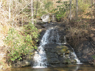
A waterfall along the road on the way to Table Rock
Table Rock. The Cherokee believed the Great Spirit sat on the peak on the right and ate meals off the "table" on the left
Table Rock as seen from the park headquarters below
The land around the park headquarters contains a large lake with a fishing pier, picnic tables and a boat ramp. These beautiful places are within an hour's drive from Townville. I'm sure we will return here another time.


No comments:
Post a Comment