
 Today is Sunday, May 30th. We had poor internet connection at the camp, and it is still too cold for us to go fishing, so we went into Gunnison, home of Western State College. We had a picnic lunch at Jorgensen Park across from the campus and the Pioneer Musuem. Here I am working on the blog updates in the park. We probably won't be able to post anything new again until we leave the high mountains on Tuesday. We will be heading for Utah.
Sunday, May 30, 2010
Today is Sunday, May 30th. We had poor internet connection at the camp, and it is still too cold for us to go fishing, so we went into Gunnison, home of Western State College. We had a picnic lunch at Jorgensen Park across from the campus and the Pioneer Musuem. Here I am working on the blog updates in the park. We probably won't be able to post anything new again until we leave the high mountains on Tuesday. We will be heading for Utah.


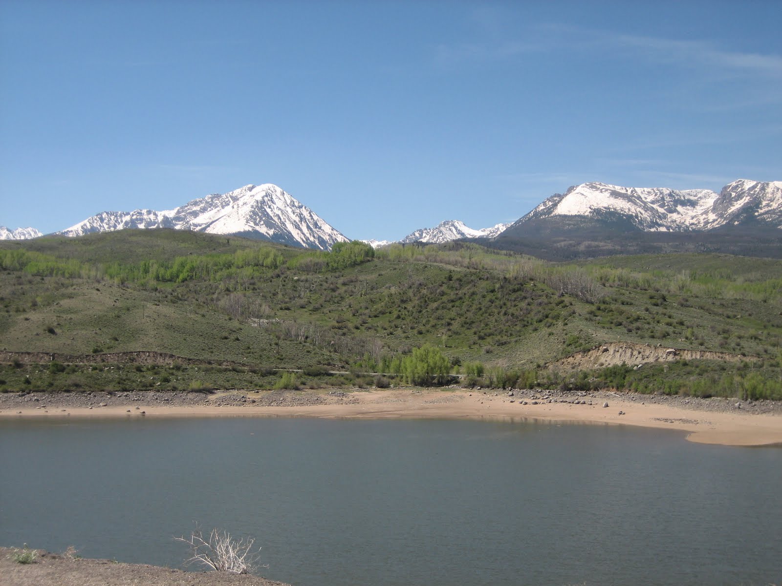
 This is the view from our campsite in Sapinero, a small recreational area on the Blue Mesa reservoir, about 30 miles west of Gunnison. The river and lake that feed the reservoir stretch for almost 20 miles. There several picnic and primitive camping sites along the way. It is still too cold and windy to attempt to go out in 'Ducky". We decided to stay here over the Memorial Day holiday to avoid traffic, so we will probably continue to do short road trips in the area.


Friday, May 28, 2010


 It was still too windy and cold to do any fishing, but we had one more day in Saratoga. We stopped at the little museum, which had a lot of interesting displays of the area, including Encampment, a town about 15 miles south at the foothills of the Sierra Madre where copper was mined in the late 1800's. Next to the museum was a beautiful pavillion. I didn't know it at the time, but there is a deer directly behind me at the back of the gazebo. Bob noticed it as he was taking the picture. If you can zoom in on the photo, you should be able to see it.
Wednesday, May 26, 2010


 Bob was able to get his prescription filled in Casper, which looked like a pretty town, and then we headed toward Saratoga, WY through the mountain basin. Here, near Medicine Bow, was a huge wind field operated by the Mountain Power Company. We were following the Sand Creek Massacre Trail along Wyoming Rte 130.
 We had stopped at Riverton on US 26/287 primarily for Bob to fill a prescription since the town had a Walgreens, but the pharmacy didn't have a supply of what Bob needed, so we had to change route and go to Casper the next day. We had stayed at the Wind River RV Park, and it was one of the worse ones. Units were doubled up, there were extra charges for everything, including showers (which we don't use since we have our own, but this was the first time I had seen a charge for use of the park showers. It was 50 cents for 3 minutes and a quarter for every minute after.). The town's biggest claim was "The 1838 Rendezvous". We had seen a historical sign for it, and went to see what it was. We were led down a rutted dirt road that ended at a private ranch with no other information. Later, we found a brochure that explained the mountain men would gather yearly at a predetermined spot where they had buried supplies for the return trip, and Riverton was the "randavouse" spot in 1838, where "plenty of trade, whiskey and white women" would be available. Interesting is that by 1838, the fur trade had pretty much ended due to diminished supply of beaver and demand since men's hats were then being made of silk. The town still celebrates the rendevous annually starting June 30 through July 4th with seminars on beaver trapping/skinning, frontier cooking, and tomahawk throwing among other frontier skills "related to the mountain man era".
Monday, May 24, 2010


 Monday, May 24, 2010, about 8 am outside the lounge/restaurant of the Yellowstone RV park where we had spent the last 3 days on the outskirts of Cody. Before we left to to to Riverton, I asked Bob to take a photo of me sitting in the rustic furniture that was on the patio. The owner of the place looked like John Wayne...at least 6'8" and he really had a class act RV park. It had been lightly raining and Bob warned me that the furniture would probably be wet, but as usual, I didn't listen to him, and ended up traveling w/a damp dupa.
Sunday, May 23, 2010


Saturday, May 22, 2010
 This picture is for my sister-in-law, Bev, who saw her first rodeo in Cody. Does it look the same, Bev?
We returned to the park after doing our errands in town, and did needed chores at the unit. We even had a few snow flurries. Tomorrow we will take another scenic drive designated as a national "red ribbon" route along Chief Joseph Scenic Byway.

May 22, 2010 errand day in Cody, WY
 On the way into Cody, the road passes along Buffalo Bill Reservoir and State Park. Colonel Cody owned this land before turning it over to the state. There is over 40 miles of shore line around the reservoir with picnic, camping, fishing, swimming and boating available. With mid morning temperatures at 46 degrees and threats of storms, not much was going on here today. There are American white pelican here. They were too far away to get a good picture. I had seen some in Yellowstone, too, but didn't believe they were white pelican until I saw some park brochures that confirmed the birds did indeed inhabit the area before heading south for the winter.
Friday, May 21, 2010
 Our stop for the next 3 days is at Yellowstone Valley RV Park about 18 miles outside of Cody, WY. The view from my little window is almost the same as the one at Gardiner, sans snow!
Another rainstorm was brewing and the wind was rocking our unit. We will head into Cody tomorrow for a little sight seeing and errand running...time to change oil in the truck and get some groceries and propane. We've gone just about 4900 miles since leaving home.


Subscribe to:
Posts (Atom)